Chilterns National Landscape – Chalk Hills, Wooded Valleys, and Open Commons
A Chalk Landscape Shaped by Escarpments, Woodland, and Long Land Use
The Chilterns National Landscape — formerly designated as an Area of Outstanding Natural Beauty — is one of southern England’s most accessible and characterful regions for walking and exploration. Stretching from Oxfordshire through Buckinghamshire and Hertfordshire into Bedfordshire, the landscape forms a long chalk ridge separating the Thames Valley from the lowlands of the Midlands and eastern England.
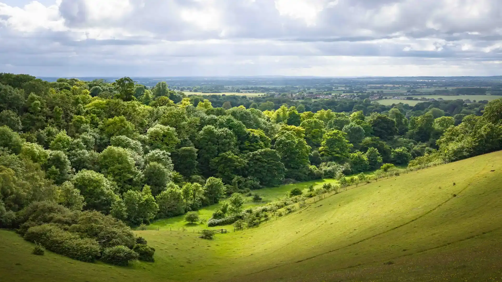
Walking in the Chilterns are defined by variety within a compact area. Open chalk downland, dense beechwoods, dry valleys, farmland, and historic villages sit close together, allowing walkers to combine short, rewarding routes with longer ridge and valley walks. The terrain is gently rolling rather than mountainous, making the area especially well suited to relaxed, self-guided journeys at every pace.
Historic routes give structure to walking across the Chilterns. The Ridgeway National Trail follows the crest of the chalk hills, offering high-level walking with far-reaching views across surrounding countryside. Below the escarpment, the ancient Icknield Way traces the foot of the hills, linking villages, farmland, and long-settled landscapes that have shaped movement through the area for thousands of years.
Together, these routes create a layered walking experience. High on the ridge, paths follow open downland and prehistoric trackways, while lower routes drift through woodland edges, chalk valleys, and village lanes. On the southern edge of the landscape, sections of the Thames Path offer gentle riverside walking, connecting historic towns, meadows, and wooded banks along the River Thames.
The chalk geology shapes everything here. Dry valleys cut through the hills, spring-fed streams appear unexpectedly in the landscape, and ancient woodland clings to steep slopes. Beechwoods dominate the higher ground, creating cool, sheltered walking in summer and rich colour in autumn, while open downland offers light-filled routes with wide horizons.
Walking routes link market towns, villages, and countryside estates, passing flint churches, old drovers’ roads, and remnants of ancient woodland. Local loops and longer circuits formed by the Chiltern Way and heritage trails allow walkers to combine ridge, valley, and woodland scenery into flexible day walks or multi-day self-guided itineraries.
Beyond walking, the Chilterns are well suited to gentle outdoor adventures. Woodland cycling, trail running, wildlife watching, and nature photography fit naturally within the landscape. Quiet lanes and bridleways favour slow, exploratory cycling, while the mix of habitats supports rich birdlife and seasonal flora.
Accommodation is spread throughout the landscape, from traditional country inns and village B&Bs to countryside hotels and rural retreats. Bases such as Henley-on-Thames, Great Missenden, Wendover, Tring, and Berkhamsted provide excellent access to footpaths, rail connections, and classic walking routes across the hills.
For walkers seeking classic English countryside, woodland-rich scenery, and well-connected paths close to major towns and cities, the Chilterns National Landscape offers one of the most rewarding and approachable walking destinations in southern England.
Where to Walk and Explore
Ridgeway National Trail
High-level walking along the chalk ridge, following prehistoric trackways with wide views across the Thames Valley and surrounding countryside.
Icknield Way
A historic route running along the foot of the chalk escarpment, linking villages, farmland, and long-settled landscapes.
Thames Path (Chilterns Section)
Gentle riverside walking between historic towns, meadows, and wooded banks along the southern edge of the National Landscape.
Chiltern Way & Heritage Trails
A network of long and short routes looping through beechwoods, chalk valleys, villages, and open countryside.
Adventure Highlights
- Rolling chalk hills and open downland walking
- Ancient beechwood forests and dry valleys
- Long-distance routes on the Ridgeway, Icknield Way, and Thames Path
- Historic villages, flint churches, and countryside estates
- Quiet lanes and bridleways for cycling and trail running
- Excellent rail access for car-free walking holidays
Frequently Asked Questions
Where is the Chilterns National Landscape located?
It lies in southern England, stretching across parts of Oxfordshire, Buckinghamshire, Hertfordshire, and Bedfordshire.
Is the Chilterns suitable for journeys on foot?
Yes — the area is ideal for gentle to moderate walking, with well-marked paths, varied scenery, and excellent transport links.
How challenging is walking in the Chilterns?
The terrain is rolling rather than steep, making it suitable for most walkers, including beginners and those seeking relaxed routes.
Can I explore the Chilterns without a car?
Yes. Many towns and villages across the landscape are served by rail, making car-free walking very achievable.
What is the best time of year to visit?
Spring and autumn are especially popular for woodland colour and comfortable walking temperatures, though the Chilterns are rewarding year-round.