Coastal Headlands, Mountain Passes, and Ireland’s Western Edge
Mountains, Blaskets, and Ireland’s Wild Atlantic Shores
The Dingle Way is a 111-mile (179 km) circular long-distance trail around the Dingle Peninsula in County Kerry. Starting and finishing in Tralee, the route follows sandy beaches, rugged cliffs, and mountain passes, making it one of Ireland’s most diverse and dramatic walking holidays.
Walkers encounter everything from long stretches of shoreline at Brandon Bay to the high mountain pass of Mount Brandon, Ireland’s second-highest peak. Along the way, the trail passes ancient beehive huts, ogham stones, and small Gaelic-speaking villages where traditional music and warm welcomes are part of the journey.
It’s a route that combines history, culture, and scenery in one of Ireland’s most iconic Wild Atlantic Way destinations.
Trail Overview
Type: National Waymarked Trail
Distance: 111 miles (179 km)
Start/End: Tralee, County Kerry
Time Required: 8–10 days
Terrain: Coastal paths, sandy beaches, mountain passes, farmland, quiet lanes
Difficulty: Moderate — gentle shoreline walking balanced with challenging upland climbs
Accessibility: Waymarked; accommodation in villages and towns along the route
Explore the Route
Tralee to Camp
The trail begins in Tralee, heading across low hills and farmland before reaching the coast at Camp on Tralee Bay.
Camp to Annascaul
From the shoreline at Camp, the path climbs over the Slieve Mish Mountains and descends into Annascaul, a village famed for explorer Tom Crean.
Annascaul to Dingle
Coastal and inland walking leads past Inch Strand before reaching Dingle, the peninsula’s lively cultural hub.
Dingle to Dunquin
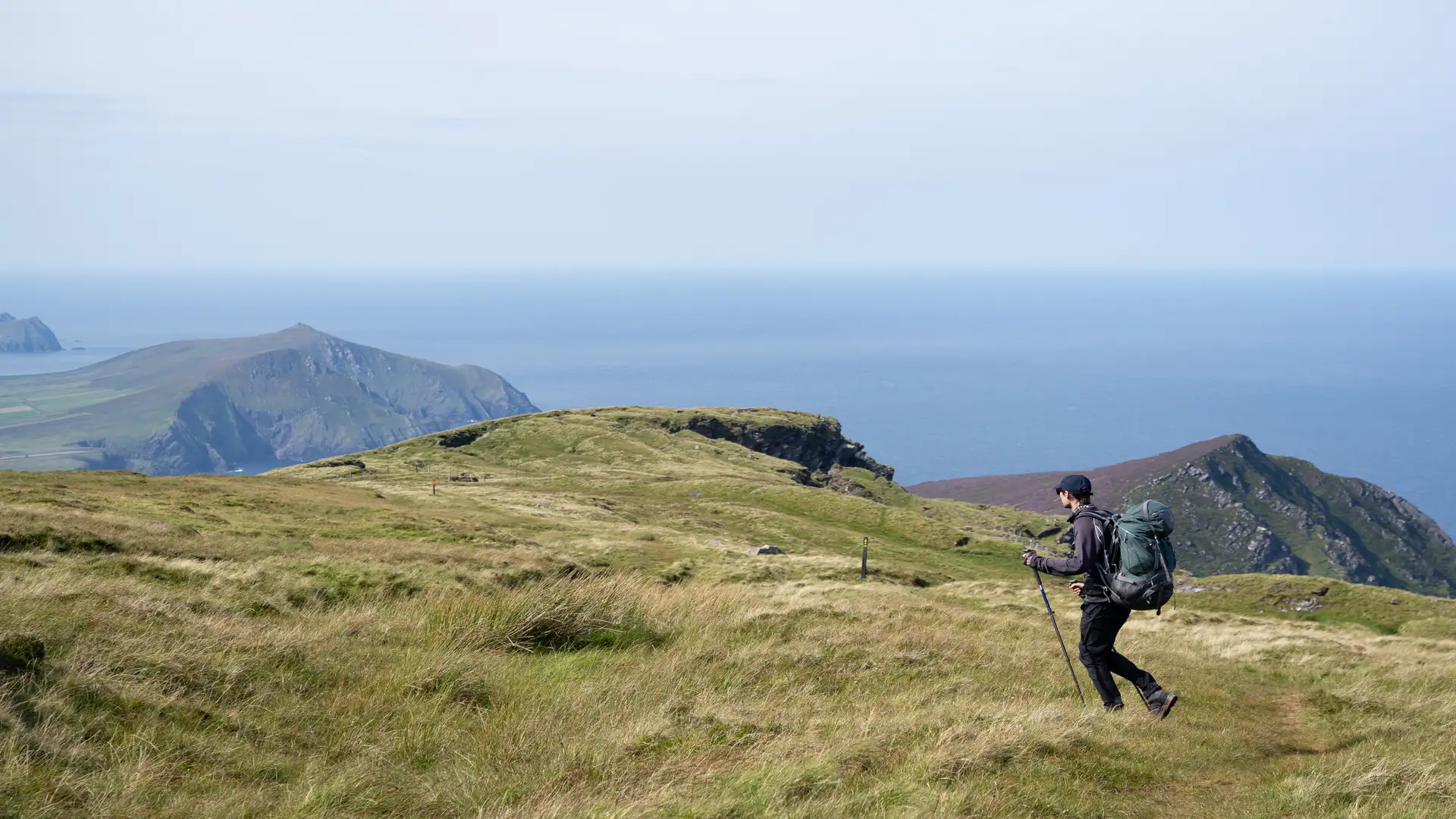
One of the most stunning sections, with views of the Blasket Islands, ancient beehive huts, and dramatic Atlantic cliffs.
Dunquin to Cloghane (via Mount Brandon)
The most challenging stage, climbing over Mount Brandon and Conor Pass — Ireland’s highest mountain pass — with sweeping views in all directions.
Cloghane to Castlegregory
A gentler coastal stage along Brandon Bay, following one of Ireland’s longest sandy beaches.
Castlegregory to Tralee
The trail continues along quiet beaches, farmland, and back inland, completing the loop at Tralee.
Stay and Explore
- Towns & Villages: Tralee, Dingle, Annascaul, Dunquin, Cloghane, Castlegregory
- Accommodation: B&Bs, guesthouses, hostels, country hotels along the route
- Food & Drink: Traditional pubs, fresh Atlantic seafood, and live music venues in Dingle
- Culture & Heritage: Beehive huts, ogham stones, medieval churches, and Gaeltacht traditions
Adventure Highlights
- Views of the Blasket Islands and Atlantic cliffs
- Mount Brandon and Conor Pass crossing
- Brandon Bay — one of Ireland’s longest beaches
- Historic villages with living Gaelic culture
- Ancient sites: beehive huts, ogham stones, and monastic remains
- A complete circuit of the Dingle Peninsula, blending coast, mountain, and heritage
