From Edale’s moorland valley all the way to the wildness of Scotland — England’s first National Trail unfolds across 268 miles (431 km) of rugged beauty.
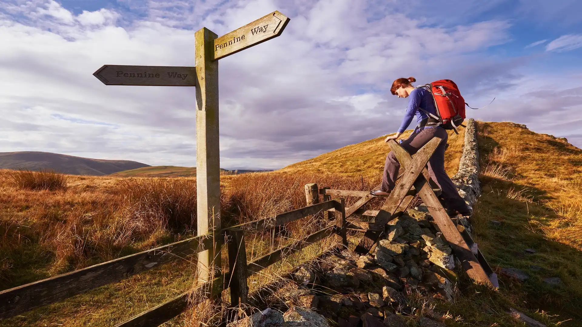
The Pennine Way is England’s most iconic long-distance footpath, stretching from Edale in Derbyshire to Kirk Yetholm just across the border in Scotland. Launched in 1965, the trail traverses the “spine of England,” crossing Derbyshire’s Dark Peak, the Yorkshire Dales, the North Pennines, Northumberland National Park, and the Cheviot Hills — offering diverse landscapes, ancient routes, and a true sense of journey.
This is walking at its purest. Over moorland, limestone dale, peat bog, and craggy hilltops, you’ll follow centuries-old paths through nature reserves and remote settlements. Each section offers a different character: from fell ridges high above Edale to riverside villages in the Dales, and from upland heaths to the wild Cheviots.
Derbyshire (Dark Peak): Begin the ascent from Edale via Jacob’s Ladder, cross Kinder Scout, and traverse gritstone moors toward Standedge.
Yorkshire Dales: Pass through Malham Cove, climb Pen-y-ghent, and cross Great Shunner Fell into Swaledale, visiting villages like Horton-in-Ribblesdale and Keld.
North Pennines & Northumberland: Follow open moorland and river valleys into Northumberland National Park, then climb into the Cheviot Hills.
Scottish Borders: Reach the ridge near Windy Gyle before descending to the official endpoint in Kirk Yetholm, gateway to Scotland’s walking routes.
You’ll find a welcoming mix of bunkhouses, village pubs, B&Bs, and occasional bothies — especially in Edale, Horton-in-Ribblesdale, Keld, and Kirk Yetholm. Many cater to long-distance hikers with luggage transfers and packed lunches.
Off the path, explore Malham Cove, High Force waterfall, sections of Hadrian’s Wall, and the market towns of Hawesand Hexham.