Ireland’s Oldest Waymarked Trail — From Dublin’s Hills to Glendalough and Beyond
The Wicklow Way is Ireland’s oldest and most accessible long-distance walking route — an 81-mile (130 km) journey from the southern edge of Dublin City through the forested mountains, valleys, and lakes of County Wicklow, known as the Garden of Ireland.
Starting in Marlay Park, the trail climbs into the Dublin Mountains, offering panoramic views over the city before descending into quiet glens and peaceful forestry. As it continues south through Glencullen, Roundwood, and Glendalough, walkers discover a landscape shaped by ancient history, from early Christian monastic sites to centuries-old sheep farms.
The Wicklow Way offers a perfect introduction to Ireland’s walking holidays — a balance of wild beauty, rich heritage, and easy accessibility. Just an hour from Dublin, yet worlds apart, it’s a route where nature, history, and hospitality meet.
Trail Overview
Type: National Waymarked Trail
Distance: 81 miles (130 km)
Start/End: Marlay Park, Dublin to Clonegal, County Carlow
Time Required: 6–8 days
Terrain: Forest paths, mountain tracks, open moorland, quiet lanes, and farmland
Difficulty: Moderate — steady ascents and descents, well-waymarked, suitable for most fit walkers
Accessibility: Excellent transport links from Dublin; accommodation options in most villages
Explore the Route
Marlay Park to Knockree
The trail begins in Dublin’s leafy suburbs before climbing into the Dublin Mountains, where views stretch across the city and coastline.
Knockree to Roundwood
Forested hills and open uplands lead through peaceful glens and farmland, passing the Powerscourt Waterfall, Ireland’s highest.
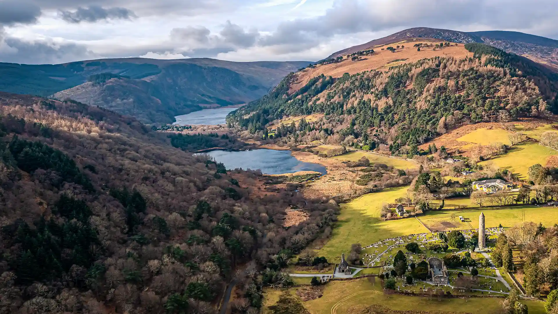
Roundwood to Glendalough
One of Ireland’s most iconic sections — descending into the Glendalough Valley, home to an early monastic settlement, twin lakes, and dramatic mountain scenery..
Glendalough to Glenmalure
Crossing mountain passes and quiet forestry tracks, walkers enter one of Wicklow’s most remote and beautiful valleys.
Glenmalure to Clonegal
The southern stages are gentler, with pastoral landscapes, country lanes, and welcoming small towns marking the final stretch into County Carlow.
Stay and Explore
Towns & Villages: Dublin, Enniskerry, Roundwood, Glendalough, Laragh, Glenmalure, Tinahely, Clonegal
Accommodation: Guesthouses, mountain lodges, hostels, and cosy B&Bs along the route
Food & Drink: Country inns, cafés in Glendalough and Laragh, and traditional Irish pubs
Culture & Heritage: Monastic ruins, ancient cairns, Georgian estates, and living rural traditions
Adventure Highlights
- Ireland’s oldest long-distance trail, established in 1980
- Links Dublin City to the wild mountains of Wicklow and Carlow
- Walk through Glendalough, Ireland’s most famous monastic site
- Panoramic views from Djouce Mountain and Lough Tay (Guinness Lake)
- Accessible yet peaceful — ideal for first-time long-distance walkers
- Combine with short breaks or car-free holidays from Dublin
- Ideal for self-guided walking holidays and outdoor adventures from Dublin.
